Flooding in the Tillamook Watershed

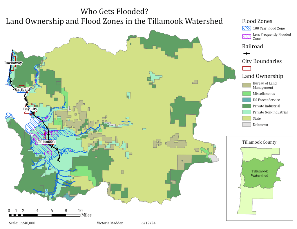
This map aims to show who owns land in the most flood-prone areas of the Tillamook Watershed. It is clear from the map that most flooding happens on privately owned land that is not used for industrial purposes, something that makes sense when thinking about who is likely to own land near rivers and water. This map can be used to help people understand the risks of buying land in certain areas so they can best plan for disaster.

Image Credit: https://floodcoalition.org/how-could-rising-floodwaters-impact-your-homes-value/

Maps of Portland

This map was an exercise in extracting, cleaning, and communicating the wealth of information found in geographic data files, including park boundaries and names, summit locations, elevations, and names, and river paths. It was important to display all these different things clearly and without obscuring any names or other information.

This map shows the various major roadways through the area of interest with each type, as classified in the source data, marked and labeled.

Image courtesy of PeakVisor.