
In the summer of 2020, the Grizzly Creek Fire burned 32,621 acres of the Glenwood Canyon. I grew up in Glenwood Springs and now live in Boulder. I was among the last five civilians on the interstate when the fire started, and was forced to drive around the mountains to get back to school about a week later. The next spring, heavy rainfall washed tons of mud, rocks, and other debris down the steep edges of the canyon and onto the road, the train tracks, and eventually into the river. These mudslides destroyed the interstate, the only major throughway to western Colorado. When I drive home now, I see piles of mud and dirt in the river, and I can see that the shape of the river has changed. I did this analysis so I could see exactly the difference in the river between before and after the fires.
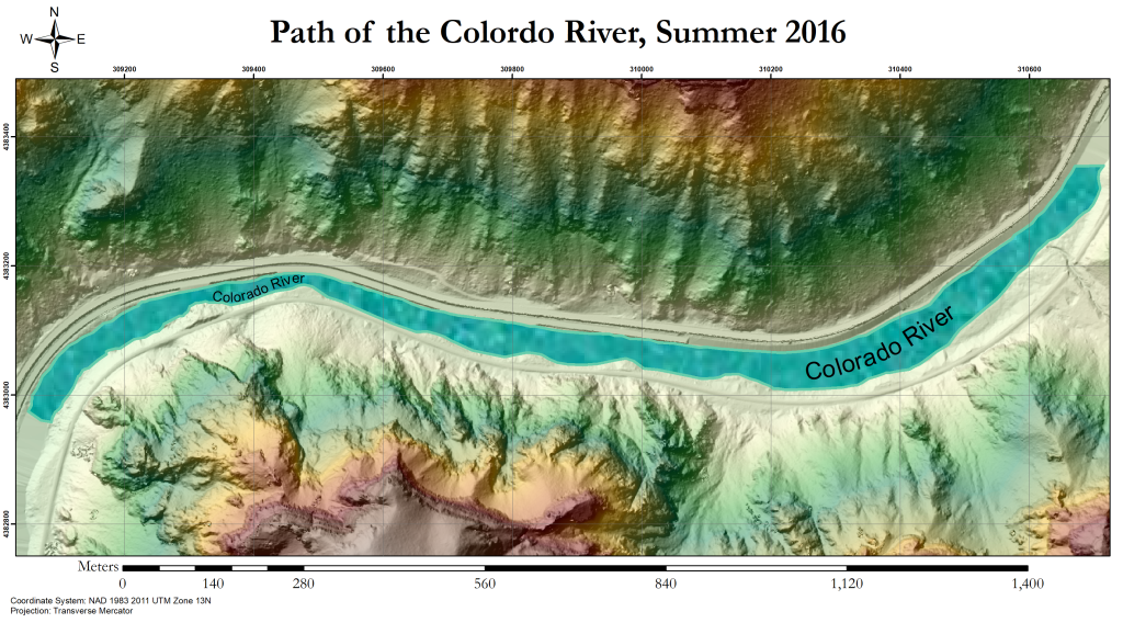
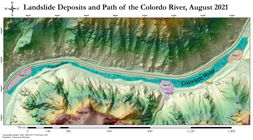
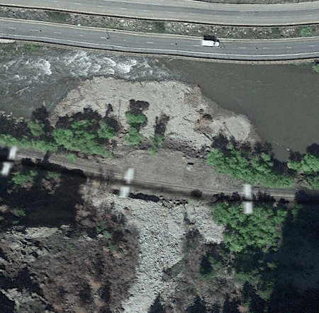
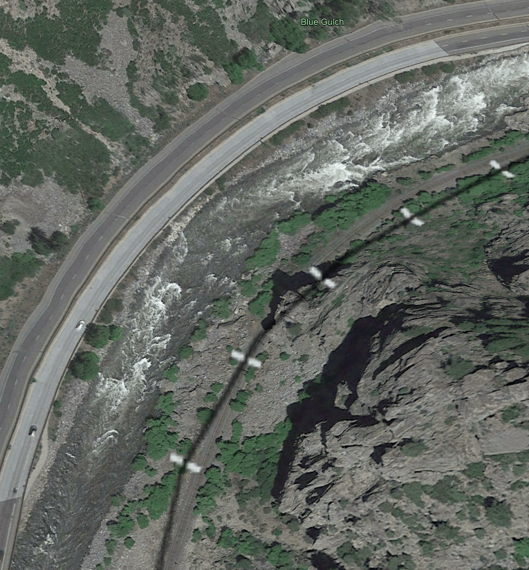
The above maps show a section of the Colorado river where mudslide debris drastically altered the shape of the river. The Colorado is a fast and narrow river, so the debris fans have been eroded away somewhat since their creation, but the riverbed still shows permanent change. Consider the below photos, pulled from Google Earth:

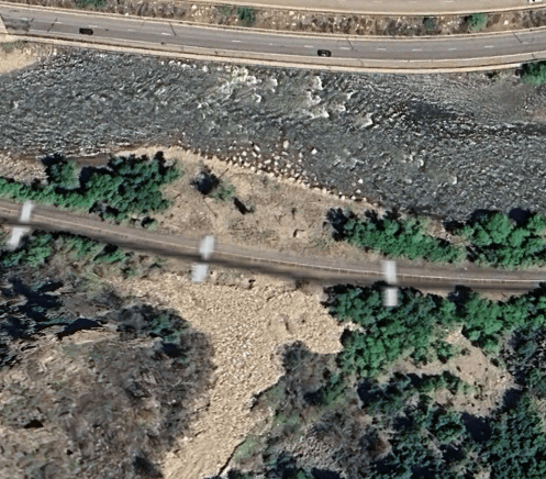
These photos show the easternmost fan, Fan 1 on the map. This was the second largest fan, and buried the train tracks. The tracks had to be dug out for freight to move through the canyon.


These photos show the westernmost fan, Fan 4 on the map. This was the largest fan, and the most destructive. You can see construction vehicles in the 2021 photo trying to remove debris to repair the interstate.
The debris fans caused measurable elevation change, as shown on the map below:

This elevation change was used to calculate the volume of the fans.
| Fan | Volume (m3) |
| 1 | 9106 |
| 2 | 617 |
| 3 | 5033 |
| 4 | 18,570 |
The river had a major reduction in width due to the fans, which I used to calculate stream power to understand how the flow changed as a result. Unfortunately, there are not any discharge meters in this area, so I used numbers averaged from upstream and downstream the area of interest.
| Width Before (m) | Width After (m) | Specific Stream Power (W/m2) | Specific Stream Power (W/m2) | |
| Fan 1 | 39.5 | 11.5 | 379.1 | 610.4 |
| Fan 4 | 41.8 | 20.6 | 1302.3 | 1238.6 |
The maps above were made with 1m resolution LIDAR flybys, and the river was traced by hand. Discharge information came from the USGS archives. All data sets and reference papers I used are listed here:
References:
1. Rengers, F.K., Bethel, M., Group, R., Vessely, M., and Anderson, S., 2023, Airborne Lidar Data (2016 and 2021) Capturing Debris Flow Erosion and Deposition after the Grizzly Creek Fire in Glenwood Canyon Colorado: U.S. Geological Survey data release, https://doi.org/10.5066/P99OT77K.
2. https://waterdata.usgs.gov/
3. Bizzi, S., and D. N. Lerner. “The Use of Stream Power as an Indicator of Channel Sensitivity to Erosion and Deposition Processes.” River Research and Applications, vol. 31, no. 1, 8 Nov. 2013, pp. 16–27, https://doi.org/10.1002/rra.2717.
This analysis was compiled into a poster for presentation purposes.

