
A quick look at where would get destroyed if Mt. Ranier were to erupt, and what would destroy those areas.
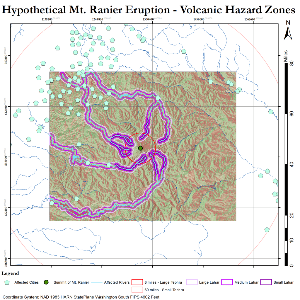
Mt. Ranier is a formidable volcano, and there is a lot of civilization near her. This map tracks where lahars are most likely to flow, as well as where large and small tephra would fall. There are dozens of cities right inside the small tephra zone, and 10 in direct danger of being hit by a lahar. The small lahar flows are 1 km in width, the medium 2 km, and the large 4 km. Large tephra are large enough to cause death upon impact, and may still be hot enough to start fires. Small tephra are other particulates that can fall with enough density to accumulate. the 60 mile range is where 10cm of small tephra accumulation is still considered possible. The red and green coloring on the area of interest indicate the slope of the ground.
A 3D model of the region is show below for clarity.
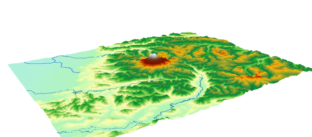
Photo Credit: Sage Ross https://commons.wikimedia.org/wiki File:Aerial_view_of_Mt._Rainier_during_a_flight_from_Seattle_to_Las_Vegas_03.jpg
